
The Area Of Concern
The farming land that Brett Aggregates have obtained is at the geographic junction point connecting the suburban communities of Upminster, Hornchurch and Elm Park. It directly borders Hornchurch Country Park nature reserve, with several woods and wildlife parks within the immediate vicinity. To the south lies Rainham, to the west Dagenham.
The Nature Reserve attracts over 150,000 people to The Essex Wildlife Trust Ingrebourne Nature Discovery Centre annually. The nature project has been a major development investment and ecological success for Havering Council, the charity organisations (such as Essex Wildlife Trust and the RSPB) and the local volunteers involved. The land directly beside where the proposed quarry may go attracts protected wildlife; including rare animal, bird and insect species.
Photo Source: Google Maps, October 2022

“In my opinion, as an ecologist, the development of a quarry next to a nature reserve will likely impact its wildlife through direct and indirect disturbance of species. Lowering connectivity with surrounding landscapes, including for foraging (e.g. bats) and dispersal and affecting flows of water through the entire area.
These impacts will likely decrease the conservation value of the reserve and require a detailed impact assessment, taking into account the special sensitivities of the site.”
Alex Rogers, Professor of Conservation Biology, Oxford University
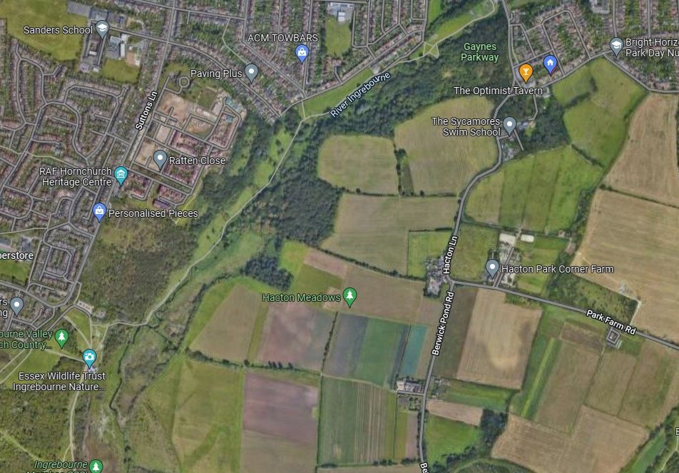
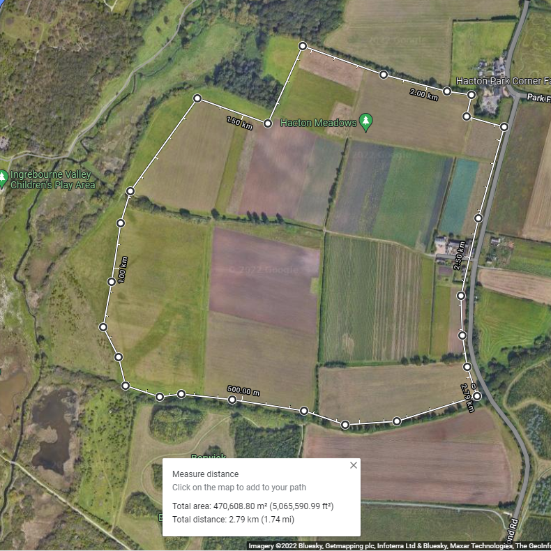
Rainham Lodge Farm, Hacton Meadows
Here we highlight Hacton Meadows, in Upminster Ward, indicating the arable farm and meadow.
This is located beside the River Ingrebourne Nature Reserve at Hornchurch Country Park, in Hornchurch and Elm Park.
The new housing development of 356 homes, beside Suttons Lane, is located closer than 300m away from the proposed quarry site.
To the west lies Dagenham, with Rainham to the south. All roads surrounding the area are narrow country lanes, without cycle lanes, pavement for pedestrians, road traffic control (such as traffic lights). Most of the lanes lack street lighting.
Photo source: Google Maps, October 2022,
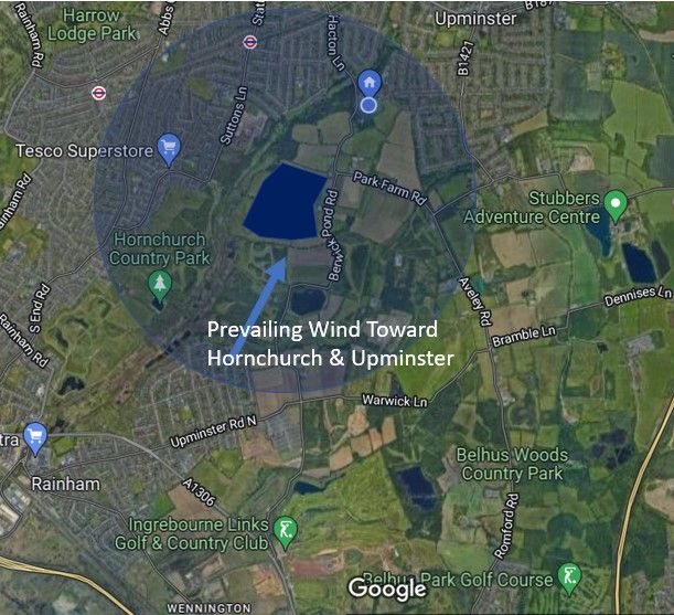
Prevailing Wind & Area Bordering The Proposed Quarry
While the wind does change direction throughout the year. The prevailing wind for most of the time is in the direction of Hornchurch, Hacton and Upminster.
The impact of dust, including any potentially harmful silicate Particulate Matter, is likely to impact the area indicated around the proposed quarry more significantly. The closer to the site, the more concentrated and potentially harmful the effects on resident health and the environment.
KEY
Dark Blue = estimated proposed quarry.
Light Blue = estimated 1 mile radius of area surrounding the centre of the proposed quarry site. This does not suggest the potential for any risk ends at 1 mile. This indication is for scale only.

We are residents, helping to protect fellow residents, schools, businesses and the environment in Havering.
Our Company is incorporated as No Quarry Ltd, registered number 14483120.
Our Registered Office is 3rd Floor, 207 Regent St, London W1B 3HH
No Quarry is a Not-for-Profit organisation, run by unpaid volunteers.
Photos owned by our supporters or creative commons/free image download services. Any questions, please contact our team at Info@NoQuarry.uk
We need your consent to load the translations
We use a third-party service to translate the website content that may collect data about your activity. Please review the details in the privacy policy and accept the service to view the translations.